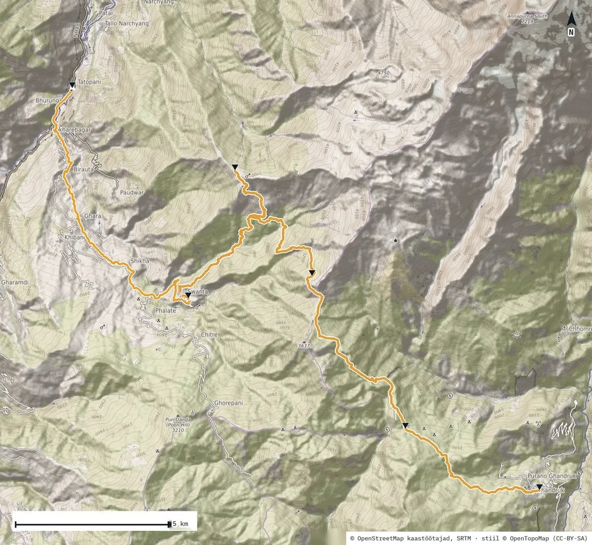
Night and morning on Khopra
I woke at 3:45. I worked on my notes in bed and thought about how to structure this travelogue. The 21st century: even 4G reaches up here. The room had a bed, sheets and a warm blanket, so the sleeping bag stayed packed. The silk liner didn’t.
The sun was about to rise. I left my warm bed and walked 90 metres higher up the ridge to watch the chauris. It was 5:50, the sun still behind the mountains. In the half-light a small animal bounded away from me. At first I thought it was a goat. It was a musk deer: no antlers, hind legs longer than the front ones, and it moves in leaps. About three thousand are left in Nepal. They live alone, move at dawn and dusk, and have been hunted for centuries for the male’s musk gland. You rarely see one.
A thousand metres down
From Khopra to the first stop was a thousand metres of descent, and it took an hour and twenty minutes. It went smoothly at first. At some point my legs made themselves felt, my knees to be exact. If you’re not used to going downhill, that’s how it goes.
“We weren’t fast, but the mountains set the pace.”
The rest stop was called Evergreen. While I waited for the others, a French group next to me, older people, were dancing, happy and enjoying their moment.
The last stretch to Swanta was a pleasant forest walk, not too steep. On the terrace of the Hotel Candle Inn I waited for my milk coffee. Muku had told me I’d get a room if I said I was a Trip Pokhara trekker, the agency that ran our trek. But the owner had never heard of it.
Swanta
For four days, wet baby wipes were all I had to wash with. Then came Swanta, a room, and in its corner a door with a proper toilet behind it. I turn on the tap and the water is warm.
I stand under it longer than I need to. At home hot water runs every day and I never once notice it. Here I had to give it up for a few days for it to come back. And it came back different: heavier, more valuable.
That is why I came here. The mountains are big and anyone can see them. You only see a small thing once it has been taken away for a while. I hope that skill makes it home with me and stays longer than the memory of hot water.
Evening on the dance floor
The hot water worked like a miracle cure. By evening the same legs whose knees had been complaining at noon were ready to dance. Nepali music started, and people danced.
Then we had a brilliant idea: let’s show them some Estonian culture too. It stayed brilliant exactly as long as it stayed in our heads. On the dance floor it found no followers. The locals watched politely, the way you watch when you’re not sure whether to clap along or call for help. A few bars later a Nepali song was playing again, and the world was back in place.
A lesson no guidebook will give you: come visit, dance along, but don’t push your own culture on your hosts.